I arrived in
Grasmere on a warm and sunny bank holiday Monday. The sky was a clear blue with the occasional white cloud drifting above in the light wind, and it
was a relief to find the village not as busy as could be expected on such a day. I had come to do a walk from the village to a nearby fell called "
Silver How". At 395 meters this was one of the lower "Wainwright" summits, but it was quite steep, had a well defined shape, and looked a bit rocky in places: a nice 'little' fell.
 |
| Silver How from Grasmere |
I set off up the narrow Red Bank Road with the picturesque Grasmere lake coming into view across the fields on my left. After a few hundred meters or so, I turned off the lane onto a steep path between two dry stone walls, with overhanging trees on one side and open fields on the other. Soon the path emerged out of the shade into an open field where I got my first glimpse of the fells on the other side of the valley.
 |
| View of Seat Sandal from the lower slopes of Silver How. |
The rocky path quickly gained height as it traversed the lower slopes of Silver How. The terrain around here was quite fascinating. Wainwright describes it in glowing terms: " ... the intermingling of crag and conifer, juniper and bracken, is landscape artistry at its best."
 |
| Looking back to Helm Crag from the lower slopes of Silver How. |
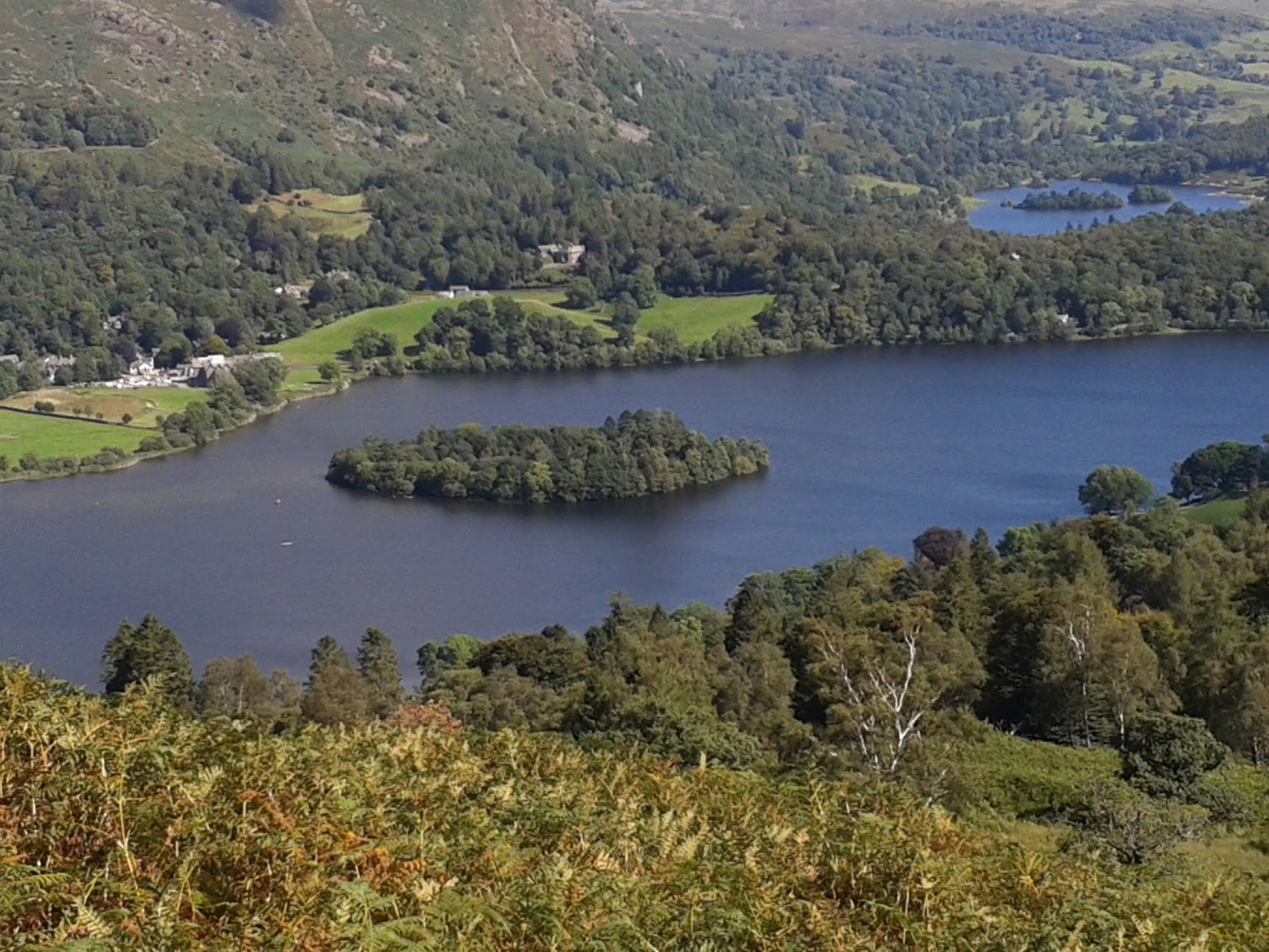
As the path followed the course of a dry stone wall, the lakes of Grasmere and Rydal Water came into view again on my left.
 |
| Grasmere lake in the foreground with Rydal Water behind. |
Up until now the path had been skirting the lower slopes of Silver How. However, it was not long before there was a turn off to the right, and a new path headed directly up through the bracken and stones towards the fell summit.
 |
| Path to the summit. |
The path actually climbed to a col between the main summit on the left of the path and a lower summit to the right. The terrain at this point started to get quite rocky.
 |
| Making my way up to the col (or hause) between the twin summits. |
 |
| A glimpse of Windermere looking back from the col. |
Once I had reached the col, the path turned off to the left to make the final push to the summit.
 |
| Path to main summit. |
The summit is situated on a ridge which separates Grasmere and Great Langdale . The views on such a clear day were spectacular. On one side I could see the Fairfield,
Helvellyn, and
Easedale range of fells, and on the other I could see the
Langdale Pikes,
Pavey Ark,
Bowfell, and Crinkle Crags.
 |
Langdale Pikes and Pavey Ark from the summit cairn at Silver How.
|
 |
Left to right: Pike o' Blisco, Crinkle Crags, and Bowfell.
|
 |
| The Fairfield range of fells. |
 |
| The Village of Grasmere. |
 |
| The lakes of Grasmere and Rydal Water from the Summit. |
I spent around half an hour or so up on the top before making my way back down to Grasmere via Wray Gill and Allan Bank.
 |
| Crossing Wray Gill on the descent to Grasmere. |
 |
St Oswald's Church in Grasmere village.
This church is the final resting place of William and Dorothy Wordsworth. |