Most people are aware that the Lake District is located in the county of Cumbria. However, not as many people know that the Lake District and Cumbria have quite different boundaries. The Lake District is a national park and covers a smaller area within the wider county.
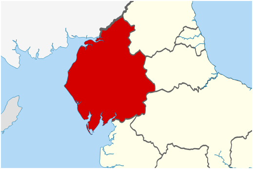 |
| The county of Cumbria highlighted in red. |
 |
| Boundaries of the Lake District in green. |
If you look at the maps above you will see that Cumbria stretches from Barrow-in-Furness and the peninsulas in the south, right up to the Scottish Border in the North. It also covers the whole of the Irish Sea coastline in the west, and the M6 corridor to the east. The Lake District, on the other hand, does not include these areas, so the Cumbrian towns of Barrow, Ulverston, Workington, Whitehaven, Cockermouth, Kendle, Penrith and Carlisle fall outside the national park boundaries.
Cumbria also hosts the north western end of the Yorkshire Dales National Park. Anybody who has driven up the M6 past the Kendal junction towards Penrith, couldn't fail to notice the impressive Howgill Fells looming up on the right hand side of the motorway. These fall within the boundaries of both Cumbria and the Yorkshire Dales, but not the Lake District itself.
 |
| The Howgill Fells as seen from the M6. |

No comments:
Post a Comment